Geo-Hydro Adds Drone Aerial Imagery to its Services
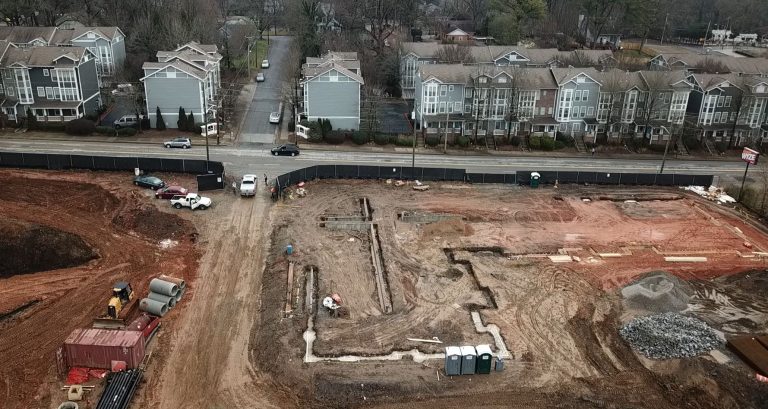
Geo-Hydro Engineers, Inc. now offers the addition of high-quality aerial imagery to any project with our new drone services. We maintain the FAA Part 107 Drone Certification from the U.S. Department of Transportation Federal Aviation Administration, allowing us to operate a drone for commercial purposes. Our team members have undergone training and honed their ability to capture professional, high-resolution photographs and videos of properties at any stage of development. We are excited to provide drone aerial imagery as a new service line to provide conception to completion documentation for any development.
The capability to obtain aerial imagery provides many advantages in our work. Aerial imagery delivers greater reach and access in site surveying and provides a quicker and more efficient approach to site assessment. In the due-diligence stage of our projects, Geo-Hydro can use a drone to visually assess areas of a site that would otherwise prove difficult to access due to extreme terrain, bodies of water, or physical hazards. The drone is also useful for capturing information on existing structures as part of a pre-demolition or pre-renovation assessment.
Drone usage also facilitates efficiency in mapping a site for geotechnical evaluations. Aerial imagery makes it easier for our team to identify site boundaries and property lines. Drones can also capture real-time data our team can process to assess a site’s topography, land elevations, and other geophysical features.
For Geo-Hydro’s projects involving construction materials testing and Special Inspections of ongoing construction, drone aerial imagery offers a “big-picture” perspective and can demonstrate site development over time. It also allows a safer and less disruptive way to access construction sites while still providing real-time inspections and observations.
As part of our commitment to providing exceptional service, Geo-Hydro takes pride in adapting cutting-edge technology. We look forward to utilizing the expansive abilities of drones to bring new elements to our work and to further our capabilities within our existing services.